Tour Highlights

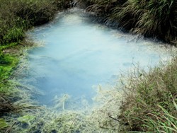
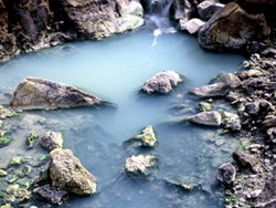
Lengshuikeng Hot Springs
Yangmingshan National Park was covered by sedimentary rock layers 2.5 million years ago. However, over a period of 2 million years, volcanoes erupted several times and the landscape gradually shaped itself into the existing volcanic landform we call the Datun Volcano Group today. After the volcanic activity ceased, post-volcanic activity such as hot springs and fumaroles continued to form this special geological landscape, and have since become some of the most defining features of Yangmingshan National Park. The park has more than ten hot springs areas, of which some were developed as early as the Japanese occupation era into bathing and tourism destinations. The park’s hot spring water can be divided into three types:
- Acid sulfate hot springs: These springs have a pH value of 2.1 to 3.0 and a wealth of sulfate ions. Typical examples include Shuangchong Creek, Sihuangping, and Gengziping hot springs.
- Acid sulfate chloride hot springs: With a pH range between 2.2 to 3.5, these springs have richer chloride ions than sulfur springs and a lower level of sulfate ions. Represented with the Macao and Dayoukeng hot springs.
- Hydrogen carbonate natural iron-bearing hot springs: The pH value ranges between 6.0 ~ 6.9 and is characterized by its near neutrality and the carbonate ions. Typical examples are the hot springs at Dingbi Bridge and Lengshuikeng.
Yangmingshan winters are easily affected by the seasonal northeast monsoon rains and winds, and the climate is very cold and wet, which offers the perfect weather and season for a relaxing soak in the hot springs. There are separate baths for both men and women at Lengshuikeng, a popular destination with many visitors every day. When traveling to Yangmingshan during the cool winter months, one can take a brisk and refreshing hike followed by a relaxing hot spring bath. These are some of life’s great pleasures—and they are good for your health, too!
Suggested Itinerary
- Taipei → Xiaoyoukeng → (1.65km, uphill) Mt. Qixing main peak → (0.3km) Mt. Qixing east peak → (1km, downhill) Menghuan Pond → (0.9km, downhill) Lengshuikeng hot springs
Feature

Hydrothermal alternated andesite rock on Dayoukeng tributaries
The trail is approximately 3.85 km long. Mt. Qixing has an elevation of 1120m. Standing on the summit, one can take in the surrounding scenery; it is the best vantage point in the entire park. There are many post-volcanic geological features such as fumaroles, sulfur crystals, metasomatism, and more.Due to the high elevation and steepness of the trail as well as strong winds on the summit, we highly recommend that visitors bring warm clothing, rain gear, drinking water, and snacks.
Getting There
- From Taipei Main Station, take the Metropolitan Transport Corporation (MTC) bus 260, or MTC bus R5 from Jiantan MRT station, and transfer to Park Bus 108 at the Yangmingshan Main Terminal and alight at the Xiaoyoukeng stop.
- On holidays and weekends, visitors can take the San-Chung bus 111 from Xinzhuang or MTC bus 109 from Wanfang community and alight at the Yangmingshan stop, then proceed to take park bus 108 from the Yangmingshan Main Bus Terminal and alight at the Xiaoyoukeng stop.
Return Trip
- From the Lengshuikeng stop, take the 108 park bus to the Yangmingshan Main Bus Terminal and transfer to MTC R5 or 260 bus to return to Shilin, Jiantan, or Taipei Main Station.On holidays and weekends, take the San-Chung bus 111 from Yangjin Highway or Shengli Road to return to Xinzhuang, or the MTC bus 109 to return to the Wanfang community.
- Take the Capital Bus Company bus S15 from Lengshuikeng to return to the MRT Jiantan station.